The Los Angeles Aqueduct Cascades facility in Sylmar is the dramatic entrance of Owens Valley water into the Los Angeles area and anyone traveling up the I-5 through Newhall pass can’t miss it. This water has traveled as much as 400 miles and has taken as long as three months to get here.

I’ve traveled the Owens Valley and the Eastern Sierra numerous times and I’ve visited the aqueduct at many points along the route. Here are some of my pictures of the Los Angeles Aqueduct.
The Los Angeles Aqueduct pretty much begins here at Grant Lake. Located at the northern end of the June Lake Loop off of US 395, this reservoir is the northernmost facility on the aqueduct. The water here in Grant Lake has been siphoned off of the creeks that feed into Mono Lake.
The amount of water that the Los Angeles Department of Water and Power can draw from the Mono Basin is limited by court order until the lake levels are restored to the same level as they were in 1963.
It’s going to be awhile before that happens …. For more on Mono Lake, visit the Mono Lake Committee website.
From Grant Lake, the water goes into an 11-mile tunnel through the Mono Craters (those two big mountains in the picture below) to join the headwaters of the Owens River. There isn’t much tunnel infrastructure to see here, and access to the Upper Owens River is difficult, so we’ll skip down to Crowley Lake.
The Owens River flows into Crowley Lake – a reservoir. This is the river flowing into the lake at the northern end.
This is Crowley Lake. For those of you who are familiar with the history, this is the property that Eaton bought in Long Valley that Mulholland had wanted for a reservoir.
After Crowley Lake, the Owens River enters the Owens Gorge. The gorge has been extensively developed by DWP for hydroelectric power. Here the river’s water is piped and tunneled through three power plants – to really understand how this works, you need to check out my Los Angeles Aqueduct slideshow (the links are at the bottom of this post).
This is the last of the three power plants., and below this plant is the Pleasant Valley Reservoir.
The water continues traveling in the natural channel of the Owens River through Bishop and further south.
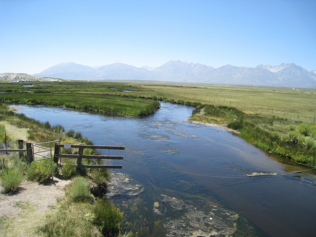
The intake for the aqueduct is approximately 10 miles north of Independence. It is here that the water will now leave the Owens River and enter the aqueduct.
At this point, the aqueduct is an unlined channel that cuts a straight line (more or less) across the valley floor.
The aqueduct heads to the Alabama Gates. The Alabama Gates have a lot of significance in aqueduct history; angry residents once dynamited the gates open, sending the water back into Owens Lake and threw a four-day party. However, eventually order was restored, the gates closed and the water once again flowed south to Los Angeles. Actually, the aqueduct was dynamited several times during the early years. For more on the history of the Los Angeles Aqueduct from an Owens Valley perspective, click here for the Owens Valley History website. (Be sure to take the links at the bottom for more pages of pictures and stories.)
At the Alabama Gates, the water enters a concrete lined channel.
Located throughout the Owens Valley are numerous groundwater pumps. Not only does DWP have rights to the waters of the Owens River, but to groundwater as well.
Owens Lake, dried up as a result of the aqueduct, is a landmark that is hard to miss. The dry lakebed still produces enormous amounts of windblown dust that exceed federal air pollution standards for particulate matter. For more on dust control, visit the Great Basin Unified Air Pollution Control District.
For those of you who have traveled this route and wondered, this is an old plate glass factory.
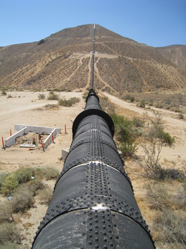
After Haiwee Reservoir, the aqueduct enters pipelines and covered conduits for the journey across the desert. There are two aqueducts that bring water from Haiwee Reservoir to Southern California. This black pipe is the original aqueduct – notice the riveted steel construction.
The first aqueduct travels through numerous siphons, tunnels, and concrete conduit. It is visible poking in and out of the foothills of the mountains along much of the 395 south of Owens Lake. At the time of construction, labor was cheap and materials to make cement abundantly available, while steel pipe was expensive and had to be fabricated on the east coast.
The second aqueduct was built in the 1970s, and at that time, labor was expensive and fabricating steel pipe relative inexpensive, so the second aqueduct nearly all pressurized pipeline. It is mostly buried, only making brief appearances to cross desert washes.
Both of the aqueducts are easily found in Jawbone Canyon. Here, the second aqueduct crosses the wash. Jawbone Canyon is a popular desert off-road area, and oftentimes people are camping here.
Further down the road is the Jawbone Siphon, one of the largest on the aqueduct.
Here you can see what the hot sun has done to the coating. I don’t think it is paint but some sort of asphalt coating. This picture was taken a few years ago, and I was told that it was slated to be repainted.
The first aqueduct crosses much of the desert in concrete conduit (below) while the second aqueduct remains buried.
The longest siphon on the aqueduct is the Antelope Siphon, which crosses the Antelope Valley. It is mostly buried.
Here is where the Los Angeles Aqueduct crosses the California Aqueduct. Infrastructure here is in place to be able to transfer water between the two systems in case of an emergency.
The aqueduct continues through the Fairmont Reservoir (once closed due to earthquake concerns and possibly still closed) and through the tunnel underneath Lake Elizabeth. The lake is not a reservoir for the aqueduct, but actually a naturally-occuring lake along the San Andreas Fault called a sag pond.
Then, the aqueduct goes through San Francisquito Canyon …
And through a two hydroelectric plants along the way. At this power plant is the historical marker for the San Francisquito Dam disaster, and behind it is the trail that you can take to the dam site.
Then the aqueduct crosses through Santa Clarita, which is where I live. The town has literally built up around the aqueduct …
Here is a funny story about how a man used the aqueduct as a road to get home when a landslide blocked the road ahead of him.
And then through Whitney and Elsmere Canyons, tunneling through the Newhall Pass, and out to the Cascades. The water cascading down from the top is actually the second aqueduct; the first aqueduct is on the lower left.
Now, if you are an aqueduct buff and if you go traveling through the Owens Valley, you’ll want to stop by the Eastern California Museum in Independence which has a lot on the aqueduct including some old DWP equipment.
You’ll also want to be sure to stop by the Interagency Visitors Center just outside of Lone Pine. They also have a lot of information on the aqueduct including a large topographic map of the aqueduct’s route.
Now I’ve left a lot out, so if you want to know more about the Los Angeles Aqueduct – history, function and more, check out my slideshow (either below or you can view the full-screen version from my website here):
For more historical information on the Los Angeles Aqueduct, check out the information on file at the Library of Congress:
You might also be interested in this photoblog post:


